Staking Out Potrero Hill
Historical Essay
by Cheryl and Clark Kaplan, 1964
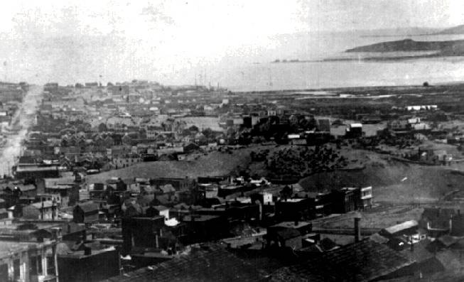
Looking southeast at Mission Bay, 1860s, Irish Hill right top and Mission Rock (center) visible.
Photo: San Francisco History Center, San Francisco Public Library
The early boundaries of Potrero Nuevo appear to have been established along Potrero Avenue on the west side. In the early days of San Francisco, one of the traffic lines into the city was the Old San Bruno Road. It ran along the peninsula into the area of Army and Nebraska Streets. Travel proceeded north on Nebraska to the intersection of Twenty-fourth Street. At this point the main traffic turned left, and then right on Potrero Avenue. Potrero Avenue extended north as far as Channel Street.
The southern boundary of Potrero Hill ran along Army Street to Islais Creek. Islais Creek is still present today, but has decreased in size and the amount of land it covers. The boundary of Potrero today follows Army Street to the approximate area of the intersection between Mississippi and Twenty-fifth Street.
The eastern boundary of Potrero was the bay which at that time, was much more deeply indented. The cover of Islais Creek has largely been filled to provide land for industrial use. There is, however, still an Islais Channel and creek situated close to the Hunter's Point area. The fill-in area begins approximately at Delaware and Twenty-third and extends southwest along the Bay to Islais Creek.
Along the early waterfront, there was Gibbon's Wharf situated close to Humboldt and Delaware Streets. Also located close to the water's edge were several salt flats.
From the approximate area of Delaware and Twenty-first, the bay cut into the area of Potrero past Irish Hill at Twenty-second and Illinois, to the area of Third and Eighteenth. At this point there was a finger of land jutting into the bay, known as Point San Quentin. The tip of this peninsula of land was in the approximate location of Seventeenth and Illinois. North around Point San Quentin, the bay again swept into a San Francisco cove where Mission Creek emptied into the salt water. The farthest point reached inland was the area of Carolina and Channel. All along this cove and south to the area of Potrero, were numerous marshlands.
The northern boundary of Potrero Hill was along Sixteenth, as it is now. These marshlands, sometimes referred to as the tidelands, were the site of several slaughter-houses and scattered industries.
Potrero at this early point of history was mostly pastureland, and was virtually an island surrounded on three sides by the bay and on the other side by a creek, called Mission Creek. Mission Bay extended from Townsend to Sixteenth Street and Kansas Avenue, and was about a mile wide. This small bay was navigable for small vessels. The Glass Company had a wharf at Iowa Street, where vessels landed their goods.
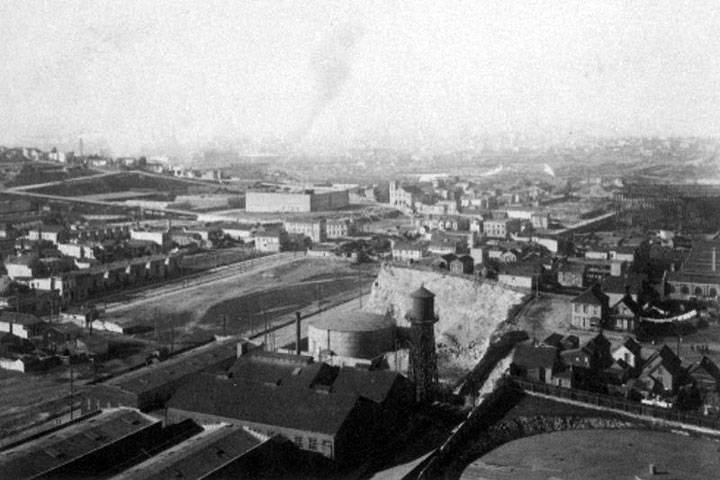
California Barrel Company, Irish Hill in right foreground, abruptly coming down at today's 3rd Street.
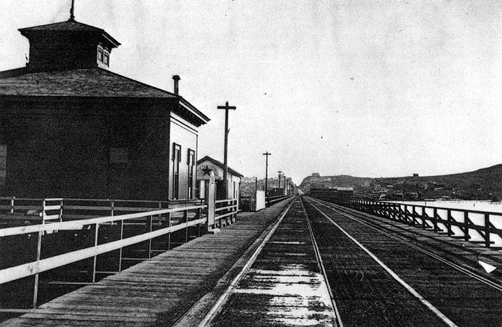
To get to Potrero at that time, it was necessary to take a road at Sixteenth and Potrero Avenue and go up the hill to a mound called Irish Hill. Then one went down past the rolling mills, or took a boat from the foot of Third Street. However, as more people settled in the Potrero, a more direct route was needed. In 1865, a bridge was built over Kentucky Street, which is now Third, from Fourth and Sixteenth Streets. It was a mile long and was called Long Bridge, or Mission Bay Bridge.
Long Bridge looking south where it bisects Irish Hill, part of Potrero Hill, approximately 1865.
Photo: Edweard Muybridge, San Francisco History Center, SF Public Library


