
Uncategorized files
Showing below up to 100 results in range #151 to #250.
 17&HARIS chuy-campusano-mural.jpg 720 × 551; 145 KB
 17-reasons bw long view.jpg 528 × 357; 38 KB
 17.gif 144 × 144; 2 KB
 17.jpg 2,000 × 1,312; 654 KB
 1700 Haight.2023.JPG 640 × 480; 91 KB
 1700 Haight.2023.sharpened.jpg 640 × 480; 259 KB
 17 at sf media archive-mission local.jpg 720 × 480; 186 KB
 17reasons50.jpg 607 × 412; 74 KB
 17th-St-west-at-Sanchez-1928-SFPL.jpg 1,080 × 706; 177 KB
 17th-and-Folsom-Summer-2013 IMG 4072.jpg 720 × 540; 83 KB
 17th-and-Folsom-parking-lot-IMG 4069.jpg 720 × 540; 67 KB
 17th-and-Folsom P1080643.jpg 720 × 481; 110 KB
 17th-and-Mars-aug-1-2009 0882.jpg 720 × 540; 95 KB
 17th-and-Shotwell-P1070540.jpg 720 × 481; 84 KB
 18.gif 144 × 144; 2 KB
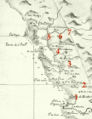 1830-map-of-Mexican-Calif w-numbers.jpg 432 × 560; 93 KB
 1836-Palou 20210327 202706527.jpg 800 × 600; 203 KB
 1837-lithograph-of-Vioget-painting-of-Yerba-Buena.jpg 792 × 343; 64 KB
 1846-18641.jpg 885 × 683; 175 KB
 1849-Eddy-Re-Survey 2321001.jpg 792 × 1,017; 311 KB
 1849 Stockton Street AAB-5363.jpg 534 × 400; 57 KB
 1849 map of YB Cove and early SF.jpg 960 × 720; 70 KB
 1850 map with Rincon Point and original YB shoreline.jpg 1,890 × 887; 1.02 MB
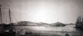
 1850s view of Yerba Buena cove from north wnp37.02585.jpg 1,000 × 633; 324 KB
 1851-Dexter-Map-3.jpg 1,080 × 606; 206 KB
 1851-Dexter-Map-4.jpg 1,080 × 566; 201 KB
 1851-Dexter-Map-5.jpg 1,080 × 476; 170 KB
 1851-Dexter-Map-w-North-at-top.jpg 1,080 × 420; 108 KB
 1851-Dexter-map-2.jpg 1,080 × 461; 147 KB
 1851-YB-cove-with-Gordon-Vulcan-Foundry-at-lower-left.jpg 720 × 426; 102 KB
 1851-shoreline-and-jurisdiction-line-map.jpg 792 × 1,000; 414 KB
 1852-Britton-and-Rey-map.jpg 1,008 × 1,288; 766 KB
 1852-US-Coast-Survey-map-of-Mission-Bay-w-Mission-Plank-Road.jpg 720 × 642; 156 KB
 1852-William-Shew-daguerreotype-of-ships-in-YB-cove.jpg 792 × 557; 170 KB
 1852-mission-bay-map.jpg 720 × 672; 187 KB
 1853-Spring-Valley-Water-Co-map-of-SF.jpg 1,152 × 624; 257 KB
 1853 closeup on bog and swamps.jpg 1,920 × 1,230; 1.79 MB
 1853 pilings.jpg 1,920 × 1,145; 1.98 MB
 1854-Bixby-Bridgens-Map-w-Sparks-Claim.jpg 1,080 × 856; 412 KB
 1854 HF Bridgens map detail.JPG 792 × 594; 285 KB
 1855-celebration-of-success-in-Crimean-War-at-South-Park-A11.19.318n.jpg 720 × 751; 195 KB
 1856-bernal-tract.png 1,186 × 477; 518 KB
 1857-USCG-map-Monkey-Block.jpg 720 × 529; 224 KB
 1857-photo-map-tubbs-cord-walk.jpg 600 × 1,150; 219 KB
 1859-USGS-Coast-Survey-Map Potrero-Hill-Mission-Bay-East-Mission-excerpt.jpg 1,080 × 975; 438 KB
 1859-tubbs-cord-walk-ad.png 600 × 260; 104 KB
 1859-us-coast-survey-map-valencia-willows-topology.png 450 × 322; 345 KB
 1860-Center-Woolen-Mills-farm-and-wateworks.jpg 923 × 423; 97 KB
 1860-mission-creek-16th-and-dolores.png 450 × 261; 130 KB
 1860-mission-willows-zoom.png 450 × 351; 202 KB
 1861-Wackenreuder-map-of-Mission-Bay.jpg 864 × 532; 244 KB
 1861-Wackenruder-Map-of-SF Potrero-Hill-excerpt.jpg 1,152 × 747; 443 KB
 1861-Wackenruder-map-Brotherhood-Way-area-detail-3867000.jpg 1,080 × 809; 286 KB
 1862-Muybridge-via-Bancroft-Library.jpg 720 × 727; 260 KB
 1862-Potrero-Point-Muybridge-via-Bancroft-Library.jpg 800 × 805; 159 KB
 1864-foot-of-second-street-by-Martin-Behrman-CHS2010.287.jpg 720 × 424; 114 KB
 1864-the-willows-18th-and-valencia-aaa-7261.jpg 450 × 340; 48 KB
 1864 election drawing.jpg 800 × 538; 386 KB
 1865-Market-betw-Taylor-and-Mason.jpg 720 × 524; 167 KB
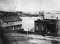
 1867-South-Beach-CHS2010.288.jpg 720 × 571; 151 KB
 1867-US-Marine-Hospital-CHS2010.285.jpg 720 × 533; 133 KB
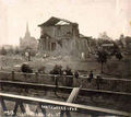 1868-quake-damage.jpg 766 × 680; 230 KB
 1868-recreation-grounds-opens.jpg 450 × 244; 50 KB
 1868 SF quake IMG 1446058323794.jpg 459 × 400; 30 KB
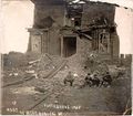
 1868 earthquake AAC-2556.jpg 792 × 622; 123 KB
 1869-Tidelands-Auction-Map.jpg 1,788 × 1,281; 739 KB
 1869 Hillside with Summer House wnp37.01617.jpg 1,000 × 915; 359 KB
 1869 Main entrance to Woodward's Gardens, Muybridge wnp26.296.jpg 1,000 × 797; 287 KB
 1870-Montgomery-&-Gold.jpg 792 × 736; 198 KB
 1870-mission-lake-oil-painting.jpg 720 × 426; 98 KB
 1871-docks-at-Rincon-Pt-by-Joseph-Lee-CHS2010.286.jpg 720 × 345; 70 KB
 1873-Bancrofts-SF-map Potrero-Hill-excerpt.jpg 1,080 × 740; 324 KB
 1873 SFSJ RR missiondist rumsey.jpg 600 × 608; 242 KB
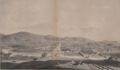
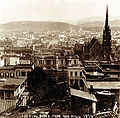 1876-south-view-from-Nob-Hill.jpg 720 × 710; 213 KB
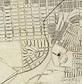
 1876 Plat-58 east-end-GG-Park.jpg 1,008 × 592; 114 KB
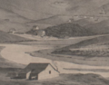
 1877-view-before-construction-on-new-seawall Bancroft-Library.jpg 800 × 558; 166 KB
 1883 Old Mint, horse car to Woodward's Gardens wnp26.338.jpg 1,000 × 668; 235 KB
 1888 Phelan Building Market and OFarrell wnp70.0809.jpg 718 × 1,000; 227 KB
 1889-coastal-survey-map-mission-bay-detail.jpg 1,800 × 1,400; 945 KB
 1890-Langley-real-estate-map-Golden-Gate-Park.jpg 800 × 575; 232 KB
 1890-address-thomas-mccann.jpg 600 × 95; 23 KB
 1890 Barbary Coast ladies AAB-6669.jpg 515 × 400; 65 KB
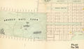
 1891-Golden-Gate-Park-map.jpg 1,008 × 434; 234 KB
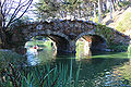 1893-bridge-on-Stow-Lake-to-Strawberry-Hill-island 4515.jpg 720 × 480; 199 KB
 1894-24-tiffany-thomas-mccann.png 445 × 852; 194 KB
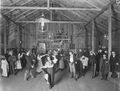 1894-Fair 1849-dancehall.jpg 720 × 547; 93 KB
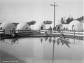 1894-Fair Esquimaux-village.jpg 720 × 537; 74 KB
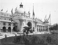 1894-Fair Manufacturers-Building.jpg 720 × 555; 97 KB
 1894-Fair White-rickshaw-puller.jpg 720 × 563; 120 KB
 1894-Fair mining-camp.jpg 720 × 558; 88 KB
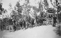 1894-Fair stagecoach-holdup.jpg 720 × 443; 95 KB


