Powhattan 1997: Difference between revisions
(changed navigation for new page) |
No edit summary |
||
| Line 3: | Line 3: | ||
[[Image:bernlhts$powhattan.jpg]] | [[Image:bernlhts$powhattan.jpg]] | ||
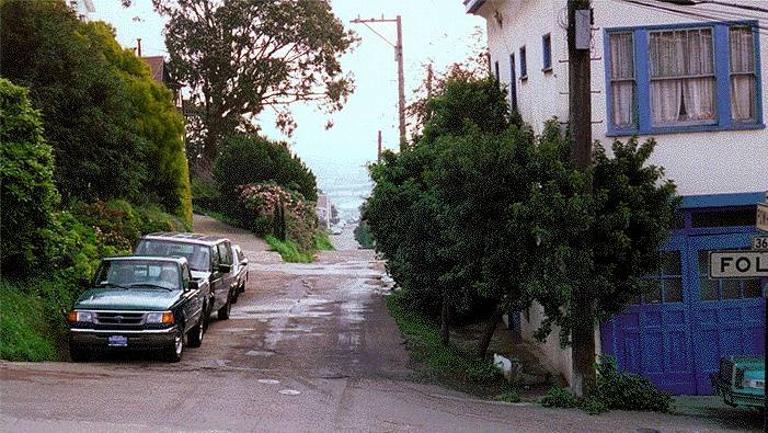
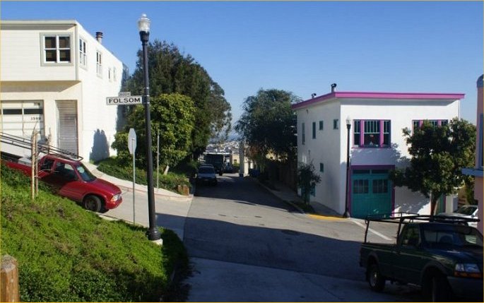
'''Powhattan Street, still not up to code in this 1997 photo | '''Powhattan Street, still not up to code in this January 1997 photo, skirts the southern edge of Bernal Heights Park, looking east from Folsom in this shot, showing it as a substandard lane, not a normal city street. It has since been widened and repaved, as shown in the photo below.''' | ||
[[File:Powhattan2011.JPG]] | |||
''top photo: Chris Carlsson'' | |||
''bottom photo: Steve Bowles'' | |||
[[Bernal's Name | Prev. Document]] [[Bernal Heights to Billy Goat Hill Walking Tour | Next Document]] | [[Bernal's Name | Prev. Document]] [[Bernal Heights to Billy Goat Hill Walking Tour | Next Document]] | ||
Latest revision as of 22:25, 4 January 2011
Unfinished History
Powhattan Street, still not up to code in this January 1997 photo, skirts the southern edge of Bernal Heights Park, looking east from Folsom in this shot, showing it as a substandard lane, not a normal city street. It has since been widened and repaved, as shown in the photo below.
top photo: Chris Carlsson
bottom photo: Steve Bowles


