Potrero Hill Historic Maps: Difference between revisions
(PC) |
(corrected Tubbs link) |
||
| (6 intermediate revisions by one other user not shown) | |||
| Line 1: | Line 1: | ||
'''<font face = arial light> <font color = maroon> <font size = 3>Unfinished History</font></font> </font>''' | '''<font face = arial light> <font color = maroon> <font size = 3>Unfinished History</font></font> </font>''' | ||
[[Image: | [[Image:1859-USGS-Coast-Survey-Map Potrero-Hill-Mission-Bay-East-Mission-excerpt.jpg|720px|thumb]] | ||
''' | '''1859 USGS Coastal Survey Map showing Potrero Hill, [[MISSION BAY|Mission Bay]] (and [[Mission Rock|Mission Rock]] out in the water), and the eastern part of the Mission District when there were two horse racing tracks occupying what is today all residential. Note the [[Tubbs Rope Walk|"rope walk"]] at shore middle left.''' | ||
'' | ''Map: courtesy [http://www.davidrumsey.com David Rumsey]'' | ||
[[Image: | [[Image:1861-Wackenruder-Map-of-SF Potrero-Hill-excerpt.jpg|720px|thumb]] | ||
'''1869 | '''1861 Wackenruder Map, showing Potrero Hill excerpt. Note the small black diagonal line indicating the "rope walk" at shore middle left (see photo below)''' | ||
''Map: courtesy [http://www.davidrumsey.com David Rumsey]'' | |||
[[Image:Map-3-1869-Salt-Marsh-Tidelands-auction-map3970000.jpg|720px|thumb]] | |||
'''1869 Salt Marsh Tidelands auction map, showing disposition of various parcels before the imminent sale of still submerged tidelands. The Tubbs Cordage Rope Walk is the larger diagonal crossing Third Street at center right.''' | |||
''Map: courtesy [http://www.davidrumsey.com David Rumsey]'' | |||
[[Image:1873-Bancrofts-SF-map Potrero-Hill-excerpt.jpg|720px|thumb]] | |||
'''1873 Bancroft Map of San Francisco, Potrero Hill and surroundings''' | |||
''Map: courtesy [http://www.davidrumsey.com David Rumsey]'' | |||
[[How to Fight City Hall and Lose |Prev. Document]] [[Good Life-Anchor Steam |Next Document]] | [[How to Fight City Hall and Lose |Prev. Document]] [[Good Life-Anchor Steam |Next Document]] | ||
[[category:Potrero Hill]] [[category:1850s]] [[category:1860s]] [[category:maps]] | [[category:Potrero Hill]] [[category:1850s]] [[category:1860s]] [[category:maps]] [[category:1870s]] | ||
Latest revision as of 01:57, 22 January 2018
Unfinished History
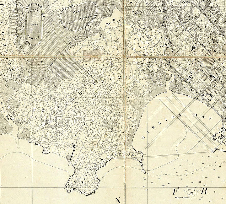
1859 USGS Coastal Survey Map showing Potrero Hill, Mission Bay (and Mission Rock out in the water), and the eastern part of the Mission District when there were two horse racing tracks occupying what is today all residential. Note the "rope walk" at shore middle left.
Map: courtesy David Rumsey
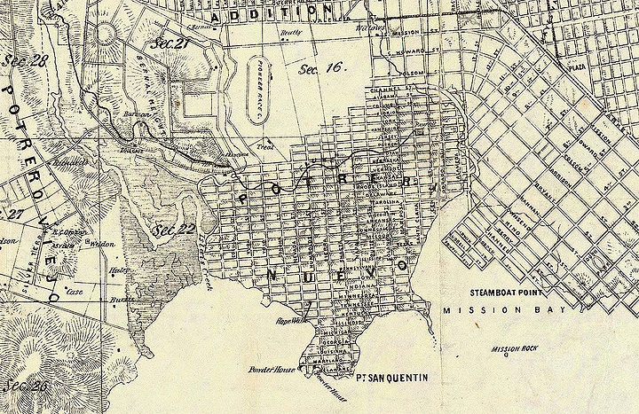
1861 Wackenruder Map, showing Potrero Hill excerpt. Note the small black diagonal line indicating the "rope walk" at shore middle left (see photo below)
Map: courtesy David Rumsey
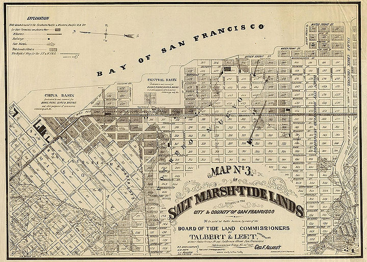
1869 Salt Marsh Tidelands auction map, showing disposition of various parcels before the imminent sale of still submerged tidelands. The Tubbs Cordage Rope Walk is the larger diagonal crossing Third Street at center right.
Map: courtesy David Rumsey
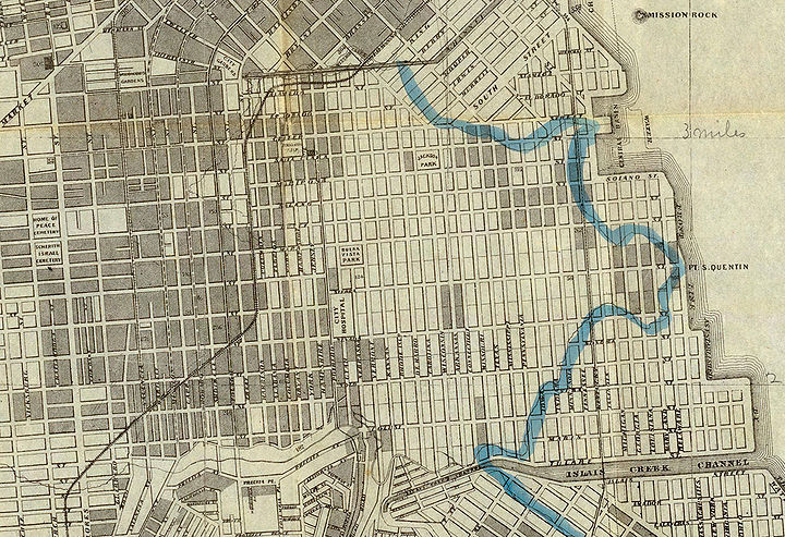
1873 Bancroft Map of San Francisco, Potrero Hill and surroundings
Map: courtesy David Rumsey


