Southeast View Across the Mission from Upper Market: Difference between revisions
mNo edit summary |
(added new photo and category) |
||
| Line 4: | Line 4: | ||
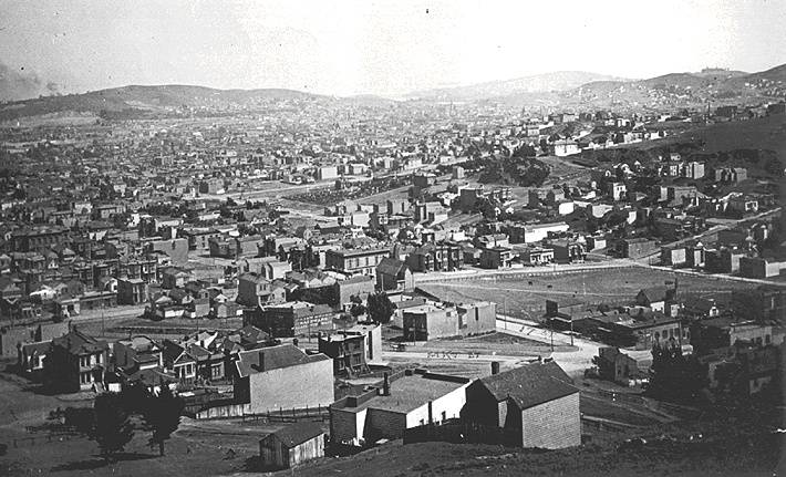
'''Southeast view, c. 1890s, across lower Castro, the Mission with Potrero Hill in distance. Market and 17th Sts. are in foreground. [[Dolores_Park-Manhattanization|Today's Dolores Park]], then a [[Jewish Cemetary|Jewish Cemetery]], is a small park area just above the center of the photo.''' | '''Southeast view, c. 1890s, across lower Castro, the Mission with Potrero Hill in distance. Market and 17th Sts. are in foreground. [[Dolores_Park-Manhattanization|Today's Dolores Park]], then a [[Jewish Cemetary|Jewish Cemetery]], is a small park area just above the center of the photo.''' | ||
''Photo: Greg Gaar Collection, San Francisco, CA'' | |||
[[Image:BVSEVW86.jpg|720px|thumb]] | |||
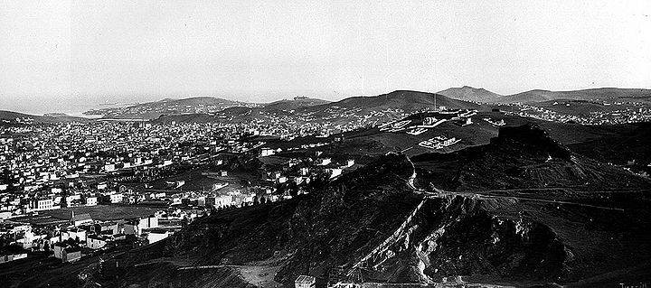
'''Somewhat wider view, c. 1880s, cemetery where Dolores Park is now, Islais Creek wetlands in distance.''' | |||
''Photo: Greg Gaar Collection, San Francisco, CA'' | |||
[[Dolores_Park_-_1906|More Dolores Park]] | [[Dolores_Park_-_1906|More Dolores Park]] | ||
[[Twin Peaks Tunnel |Prev. Document]] [[Market and Church |Next Document]] | [[Twin Peaks Tunnel |Prev. Document]] [[Market and Church |Next Document]] | ||
[[category:Castro]] [[category:1890s]] | [[category:Castro]] [[category:1890s]] [[category:1880s]] | ||
Revision as of 23:40, 12 February 2013
Unfinished History
Southeast view, c. 1890s, across lower Castro, the Mission with Potrero Hill in distance. Market and 17th Sts. are in foreground. Today's Dolores Park, then a Jewish Cemetery, is a small park area just above the center of the photo.
Photo: Greg Gaar Collection, San Francisco, CA
Somewhat wider view, c. 1880s, cemetery where Dolores Park is now, Islais Creek wetlands in distance.
Photo: Greg Gaar Collection, San Francisco, CA


