Point Lobos to Geary—Early 20th Century: Difference between revisions
(added Charles Ruiz photos) |
(changed credit on 1900 and 1927 SFPL photos which came from C.R. collection) |
||
| (4 intermediate revisions by 2 users not shown) | |||
| Line 5: | Line 5: | ||
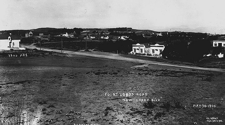
'''Northwesterly view from 31st Avenue near Geary (then Point Lobos Road), with cemetery visible at Lincoln Park, May 30, 1900.''' | '''Northwesterly view from 31st Avenue near Geary (then Point Lobos Road), with cemetery visible at Lincoln Park, May 30, 1900.''' | ||
''Photo: San Francisco History Center, | ''Photo: San Francisco History Center, San Francisco Public Library'' | ||
| Line 12: | Line 12: | ||
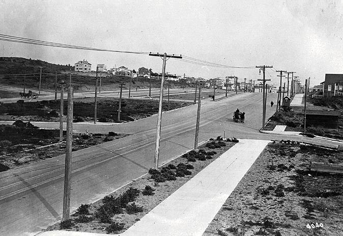
'''Looking east at the intersection of Geary and 43rd in 1917. Horse and buggy travel was still common at the time. To the left of Geary is Point Lobos.''' | '''Looking east at the intersection of Geary and 43rd in 1917. Horse and buggy travel was still common at the time. To the left of Geary is Point Lobos.''' | ||
''Photo: Private Collection | ''Photo: Private Collection'' | ||
[[Image:Geary-West-at-22nd-Ave-1927-SFPL.jpg|720px]] | |||
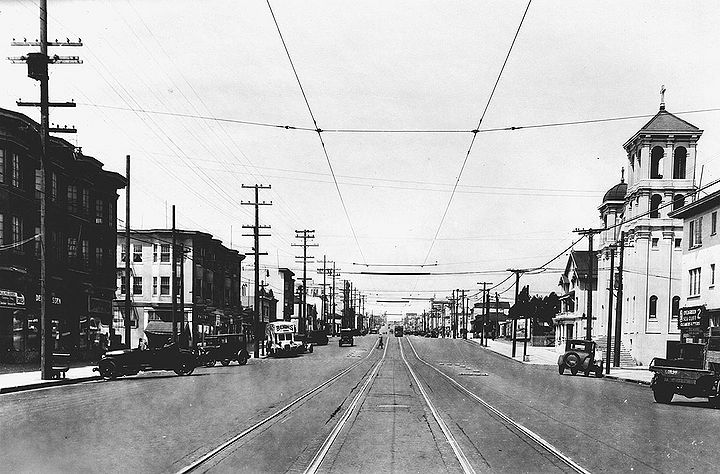
'''Geary Blvd. west looking at the intersection with 23rd Avenue, 1927.''' | |||
'' | ''Photo: San Francisco History Center, San Francisco Public Library'' | ||
''Photo: San Francisco History Center, | [[Image:Geary-east-at-33rd-Ave-1927-SFPL.jpg|720px]] | ||
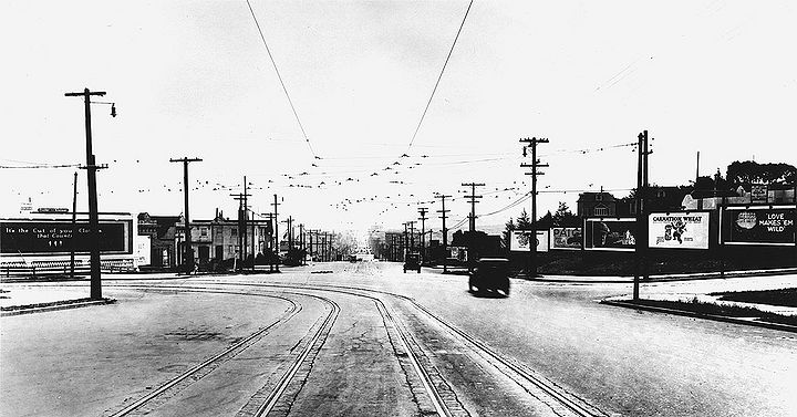
'''Geary Blvd. east at 33rd Avenue, 1927.''' | |||
''Photo: San Francisco History Center, San Francisco Public Library' | |||
[[Sutro Heights |Prev. Document]] [[The Chutes at Fulton and 10th Ave., 1902-1907 |Next Document]] | [[Sutro Heights |Prev. Document]] [[The Chutes at Fulton and 10th Ave., 1902-1907 |Next Document]] | ||
[[category:Richmond]] [[category:1910s]] [[category:Transit]] [[category:1920s]] [[category:1900s]] [[category:roads]] | [[category:Richmond District]] [[category:1910s]] [[category:Transit]] [[category:1920s]] [[category:1900s]] [[category:roads]] | ||
Latest revision as of 17:56, 12 July 2016
Unfinished History
Northwesterly view from 31st Avenue near Geary (then Point Lobos Road), with cemetery visible at Lincoln Park, May 30, 1900.
Photo: San Francisco History Center, San Francisco Public Library
Looking east at the intersection of Geary and 43rd in 1917. Horse and buggy travel was still common at the time. To the left of Geary is Point Lobos.
Photo: Private Collection
Geary Blvd. west looking at the intersection with 23rd Avenue, 1927.
Photo: San Francisco History Center, San Francisco Public Library
Geary Blvd. east at 33rd Avenue, 1927.
Photo: San Francisco History Center, San Francisco Public Library'


