Living on the Slopes: Difference between revisions
mNo edit summary |
(added photo) |
||
| (11 intermediate revisions by 2 users not shown) | |||
| Line 3: | Line 3: | ||
[[Image:castro1$eureka-valley-north-slope.jpg]] | [[Image:castro1$eureka-valley-north-slope.jpg]] | ||
'''Life on upper Eureka Valley's [[Vulcan and Saturn Steps|north slope]], Buena Vista park at upper right, c. 1910s.''' | '''Life on upper Eureka Valley's [[Vulcan and Saturn Steps|north slope]], Buena Vista park at upper right. Corbett Road runs across the bottom, the curving dirt road at center left is [[17th and Mars|Mars Street connecting it to 17th Street]] which is the straight diagonal road going uphill to the left (west), c. 1910s.''' | ||
''Photo: Private Collection, San Francisco, CA'' | ''Photo: Private Collection, San Francisco, CA'' | ||
[[Image:Roosevelt and Levant May 28, 1920 opensfhistory wnp36.02313.jpg|800px]] | |||
'''Roosevelt and Levant, May 28, 1920.''' | |||
''Photo: OpenSFHistory.org wnp36.02313'' | |||
[[Image:Eureka Valley and Buena Vista Park. 2005.jpg]] | [[Image:Eureka Valley and Buena Vista Park. 2005.jpg]] | ||
'''View of | '''View of Eureka Valley, Buena Vista park at upper left, and Corona Heights Park at upper right, 2005.''' | ||
''Photo: From the [[Corwin Park to Tank Hill|Corwin Park to Tank Hill]] walk's Flickr photos.'' | |||
[[Image:Eureka valley north slope apx roosevelt 1890s.jpg]] | [[Image:Eureka valley north slope apx roosevelt 1890s.jpg]] | ||
| Line 16: | Line 24: | ||
''Photo: Private Collection, San Francisco, CA'' | ''Photo: Private Collection, San Francisco, CA'' | ||
[[Image:Ellen sweeney1-1-.jpg|800px]] | |||
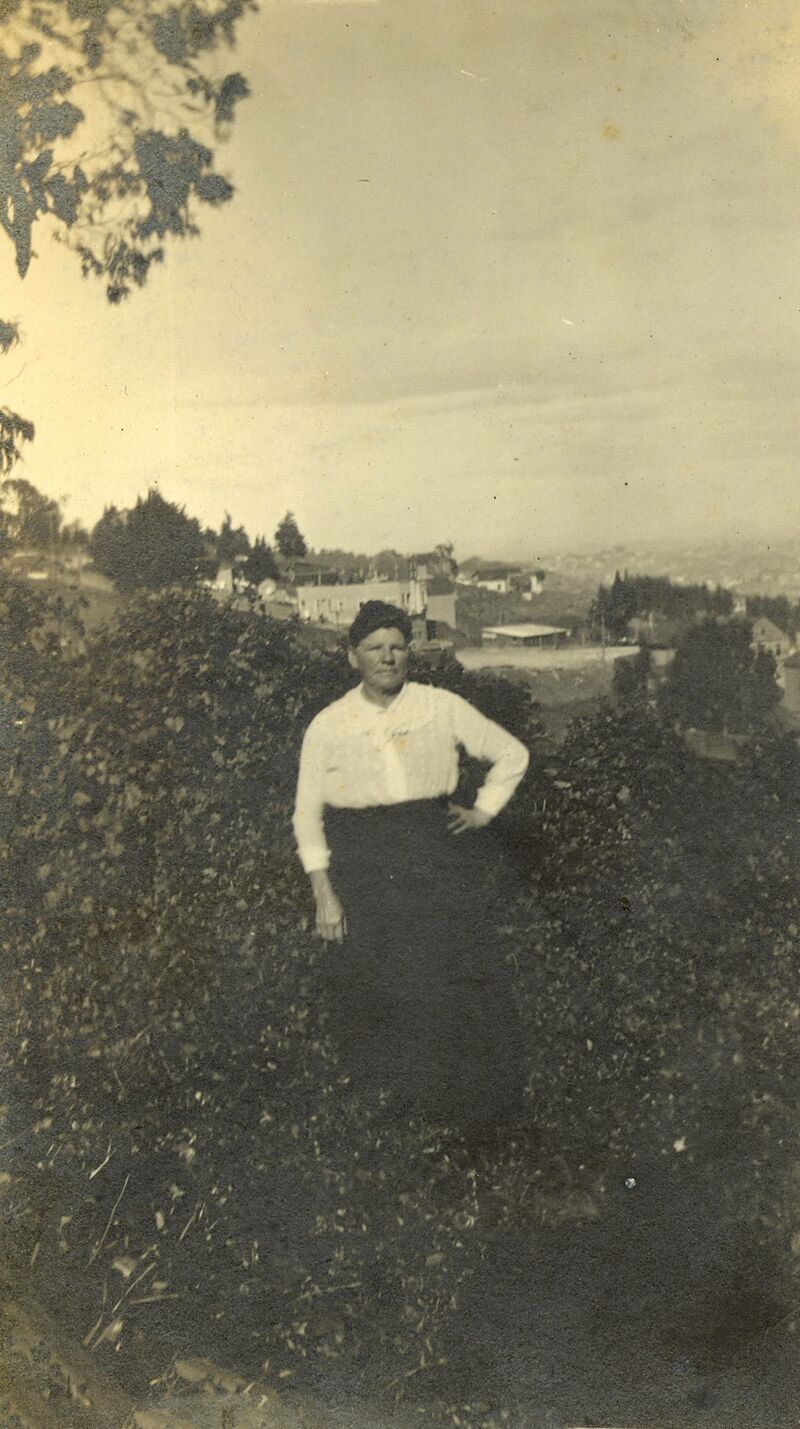
'''Buckley family history.''' This photo was taken at my great-great-grandmother Ellen Sweeney Buckley's farm at 1063 Corbett Street. | |||
''Photo: courtesy Buckley Family'' | |||
[[Cable Car - Castro 1939 |Prev. Document]] [[Vulcan and Saturn Steps| Next Document]] | [[Cable Car - Castro 1939 |Prev. Document]] [[Vulcan and Saturn Steps| Next Document]] | ||
[[category:Castro]] [[category:Eureka Valley]] [[category:1890s]] [[category:1910s]] | [[category:Castro]] [[category:Eureka Valley]] [[category:1890s]] [[category:1910s]] [[category:1920s]] [[category:2000s]] | ||
Latest revision as of 20:52, 19 June 2023
Unfinished History
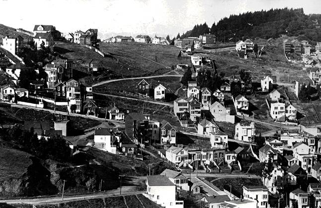
Life on upper Eureka Valley's north slope, Buena Vista park at upper right. Corbett Road runs across the bottom, the curving dirt road at center left is Mars Street connecting it to 17th Street which is the straight diagonal road going uphill to the left (west), c. 1910s.
Photo: Private Collection, San Francisco, CA
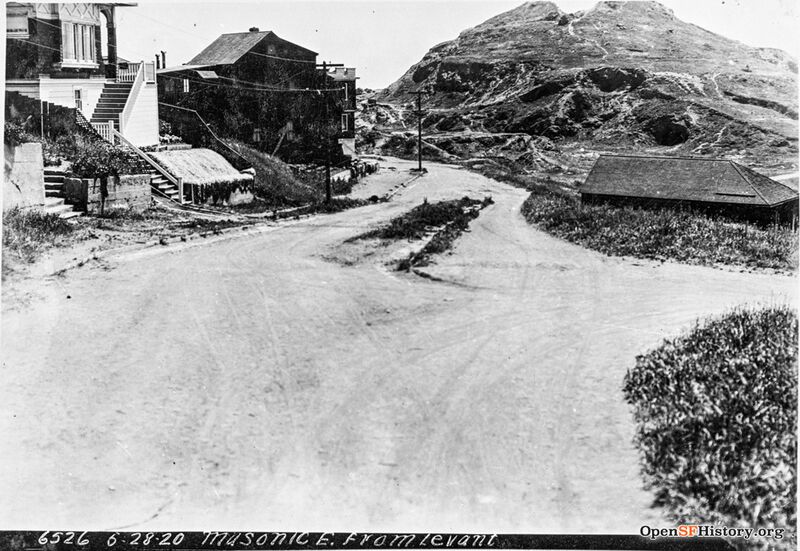
Roosevelt and Levant, May 28, 1920.
Photo: OpenSFHistory.org wnp36.02313
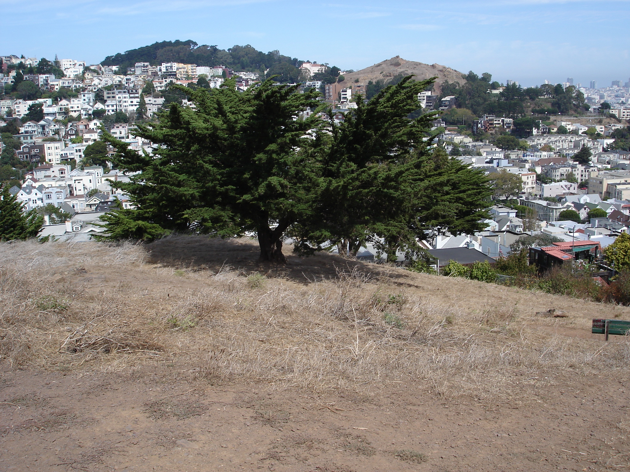
View of Eureka Valley, Buena Vista park at upper left, and Corona Heights Park at upper right, 2005.
Photo: From the Corwin Park to Tank Hill walk's Flickr photos.
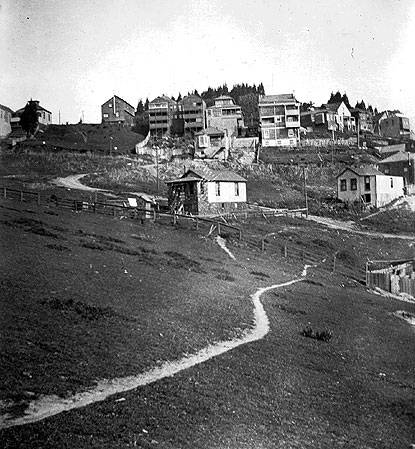
Eureka Valley north slope, c. 1890s.
Photo: Private Collection, San Francisco, CA
Buckley family history. This photo was taken at my great-great-grandmother Ellen Sweeney Buckley's farm at 1063 Corbett Street.
Photo: courtesy Buckley Family

