
File:Lake dolores map overlay.jpg
No higher resolution available.
Lake_dolores_map_overlay.jpg (620 × 466 pixels, file size: 94 KB, MIME type: image/jpeg)
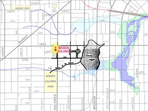
Biologist Christopher Richard has researched waterways throughout the Bay Area. This is his map of the water flow in the Mission District. It includes historic streams, tidal inlets and marshlands that no longer exist in the urban environment.The dark blue shows where the tidal inlet was, and the light blue is shallow seasonal wet areas.The black map is a replica of the historical monument displayed at the intersection of Camp and Albion, showing a freshwater lake that Richard disputes. From http://missionlocal.org/2011/02/unraveling-the-mystery-of-lake-dolores/
File history
Click on a date/time to view the file as it appeared at that time.
| Date/Time | Thumbnail | Dimensions | User | Comment | |
|---|---|---|---|---|---|
| current | 22:04, 25 February 2011 | | 620 × 466 (94 KB) | Lisaruth (talk | contribs) | « Previous Post Good Morning, Mission! » Unraveling the Mystery of Lake Dolores Biologist Christopher Richard has researched waterways throughout the Bay Area. This is his map of the water flow in the Mission District. It includes historic streams, tid |
You cannot overwrite this file.
File usage
The following page uses this file: