Dolores Park-Manhattanization: Difference between revisions
(added Charles Ruiz photos) |
(added photo) |
||
| (3 intermediate revisions by 2 users not shown) | |||
| Line 1: | Line 1: | ||
'''<font face = arial light> <font color = maroon> <font size = 3>Unfinished History</font></font> </font>''' | '''<font face = arial light> <font color = maroon> <font size = 3>Unfinished History</font></font> </font>''' | ||
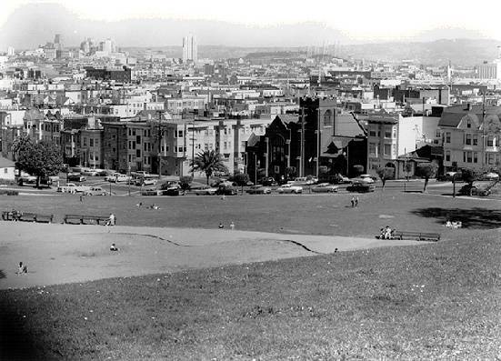
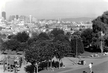
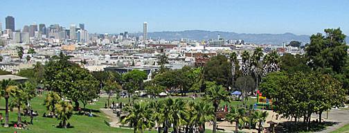
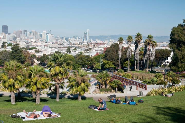
'''Photographs, taken in 1960, 1994, 2008, and | '''Photographs, taken in 1960, 1994, 2008, 2013, and 2016 showing San Francisco's growing downtown skyline as seen from Dolores Park''' | ||
[[Image:mission$dolores-park-ne-view-1960.jpg]] | [[Image:mission$dolores-park-ne-view-1960.jpg]] | ||
| Line 7: | Line 7: | ||
'''Manhattanization on view from Dolores Park, 1960''' | '''Manhattanization on view from Dolores Park, 1960''' | ||
''Photo: Private Collection | ''Photo: Private Collection'' | ||
[[Image:mission$dolores-park-ne-view-1994.jpg]] | [[Image:mission$dolores-park-ne-view-1994.jpg]] | ||
| Line 26: | Line 26: | ||
''Photo: Kathleen Yago'' | ''Photo: Kathleen Yago'' | ||
[[Image:Dolores-Park 20160901 190252.jpg]] | |||
'''After further park renovation and more downtown building, a near dusk view in September 2016.''' | |||
''Photo: Chris Carlsson'' | |||
[[Image:Church-St-north-at-20th-1920 72dpi.jpg|720px]] | [[Image:Church-St-north-at-20th-1920 72dpi.jpg|720px]] | ||
| Line 31: | Line 37: | ||
'''Church Street north at 20th, 1920.''' | '''Church Street north at 20th, 1920.''' | ||
''Photo: | ''Photo: C. R. collection'' | ||
[[Image:Dolores Park circa 1950 wnp5.51190.jpg|800px]] | |||
'''Dolores Park, J-Church heading southbound, c. 1950.''' | |||
''Photo: OpenSFHistory.org wnp5.51190'' | |||
| Line 44: | Line 56: | ||
[[The Mission Becomes a Resort, 1850s |Prev. Document]] [[For Whom the Belle Toils: |Next Document]] | [[The Mission Becomes a Resort, 1850s |Prev. Document]] [[For Whom the Belle Toils: |Next Document]] | ||
[[category:Mission]] [[category:1960s]] [[category:1990s]] [[category:1910s]] [[category:Transit]] [[category:downtown]] | [[category:Mission]] [[category:1960s]] [[category:1990s]] [[category:1910s]] [[category:Transit]] [[category:downtown]] [[category:2010s]] [[category:1950s]] | ||
Revision as of 16:33, 25 May 2020
Unfinished History
Photographs, taken in 1960, 1994, 2008, 2013, and 2016 showing San Francisco's growing downtown skyline as seen from Dolores Park
Manhattanization on view from Dolores Park, 1960
Photo: Private Collection
Skyline changes seen from Dolores Park, 1994
Photo: David Green
Skyline changes seen from Dolores Park, 2008
Photo: Chris Carlsson
Skyline changes seen from Dolores Park, 2013. A new playground is also visible, renovated in 2012.
Photo: Kathleen Yago
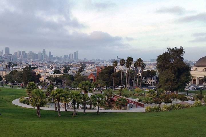
After further park renovation and more downtown building, a near dusk view in September 2016.
Photo: Chris Carlsson
Church Street north at 20th, 1920.
Photo: C. R. collection
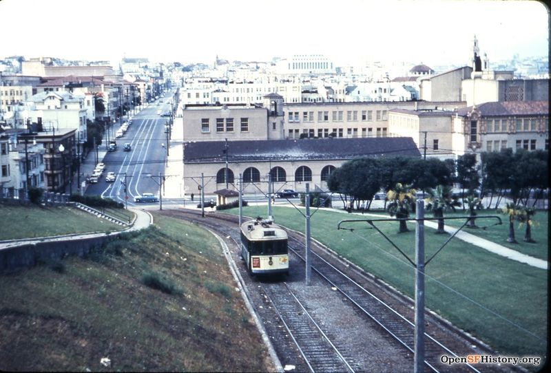
Dolores Park, J-Church heading southbound, c. 1950.
Photo: OpenSFHistory.org wnp5.51190
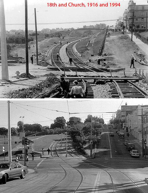
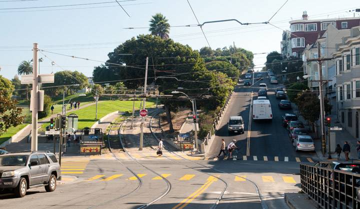
Lower photo shows a much more verdant vista from 18th and Church, 2013.
Photo: Kathleen Yago

