Alemany view: Difference between revisions
(improved caption) |
(added new image) |
||
| Line 6: | Line 6: | ||
''photo: Greg Gaar Collection; caption: [http://www.bernalhistoryproject.org// Bernal Heights History Project]'' | ''photo: Greg Gaar Collection; caption: [http://www.bernalhistoryproject.org// Bernal Heights History Project]'' | ||
[[Image:Islais-wetlands-1940s-w-powerplant-at-right-shore 3023.jpg]] | |||
'''Former wetlands of Islais Creek, now enclosed and largely filled in this 1940 photo.''' | |||
''Photo: San Francisco Planning Commission archives'' | |||
[[East Slope Bernal Heights| Prev. Document]] [[Islais Creek wetlands | Next Document]] | [[East Slope Bernal Heights| Prev. Document]] [[Islais Creek wetlands | Next Document]] | ||
[[category:Bernal Heights]][[category:1910s]] [[category:water]] | [[category:Bernal Heights]][[category:1910s]] [[category:water]] [[category:1940s]] | ||
Revision as of 19:14, 7 August 2011
Unfinished History
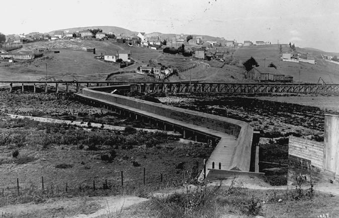
1912 photo of Bernal Heights south slope shows an intersection of the Ocean Shore Railroad and the Alemany water flume. The flume carried water from Islais Creek near Glen Park around the south and east slopes of Bernal Hill to a reservoir at Sixteenth and Brannan Streets. It was constructed in 1860, owned by Spring Valley Water Works.
photo: Greg Gaar Collection; caption: Bernal Heights History Project
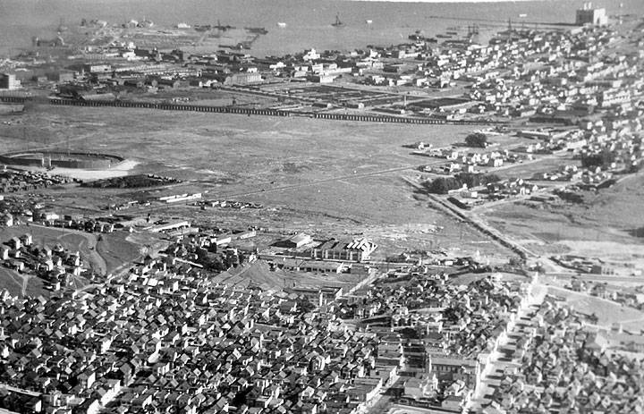
Former wetlands of Islais Creek, now enclosed and largely filled in this 1940 photo.
Photo: San Francisco Planning Commission archives


