St Mary's Development: Difference between revisions
No edit summary |
m (Ccarlsson moved page St Mary's Development 1925 to St Mary's Development) |
||
| (9 intermediate revisions by 3 users not shown) | |||
| Line 1: | Line 1: | ||
[[Image:excelvis$silver-avenue-east-view-1925.jpg]] | '''<font face = arial light> <font color = maroon> <font size = 3>Unfinished History</font></font> </font>''' | ||
[[Image:excelvis$silver-avenue-east-view-1925.jpg|720px|thumb]] | |||
'''Silver Avenue view: 1925 northeastward towards the new [[St Mary's Residential Tract| St. Mary's Park residential tract]] southwest of Bernal Heights ''' | '''Silver Avenue view: 1925 northeastward towards the new [[St Mary's Residential Tract| St. Mary's Park residential tract]] southwest of Bernal Heights ''' | ||
'' | ''Private Collection, San Francisco, CA'' | ||
[[Image:Nov 24 1941 View Southeast toward Alemany Boulevard and Silver Terrace from the east edge of St. Mary's Park (St. Mary's Recreation Center) DPW A7043 wnp26.051.jpg]] | |||
'''November 24, 1941: View southeast toward Alemany Boulevard and Silver Terrace from the east edge of St. Mary's Park. Ponds visible at bottom of hill where Alemany Public Housing is today.''' | |||
''Photo: OpenSFHistory.org, wnp26.051, DPW A7043'' | |||
[[McLaren | [[Philosopher's Way at McLaren Park |Prev. Document]] [[Crocker Amazon Tract Notables | Next Document]] | ||
[[category:Excelsior]] [[category:1920s]] [[category:Bernal Heights]] | [[category:Excelsior]] [[category:1920s]] [[category:Bernal Heights]] [[category:1940s]] | ||
Revision as of 17:52, 10 January 2020
Unfinished History
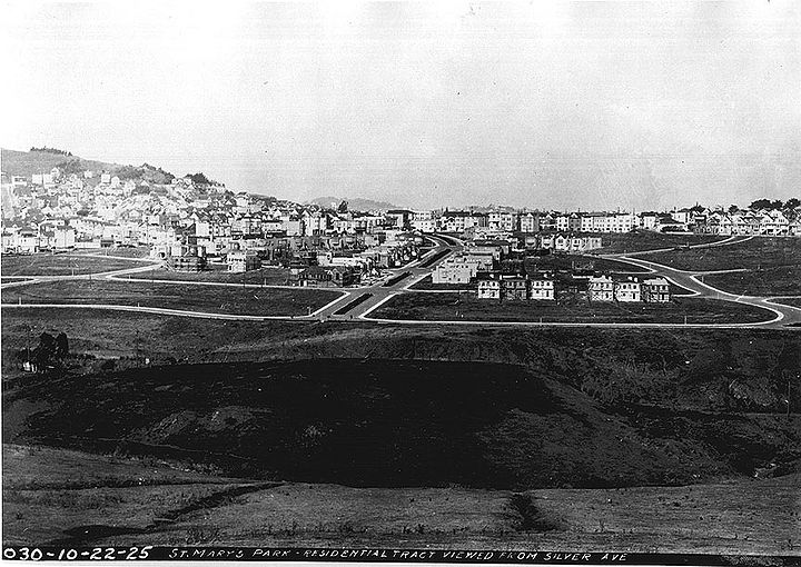
Silver Avenue view: 1925 northeastward towards the new St. Mary's Park residential tract southwest of Bernal Heights
Private Collection, San Francisco, CA
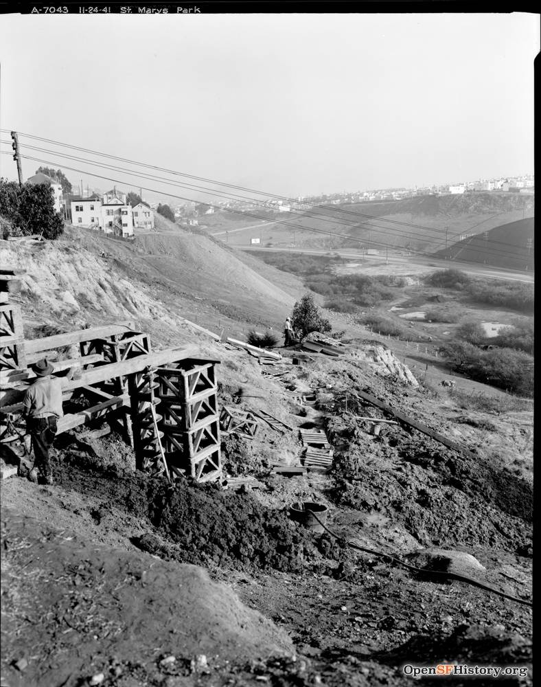
November 24, 1941: View southeast toward Alemany Boulevard and Silver Terrace from the east edge of St. Mary's Park. Ponds visible at bottom of hill where Alemany Public Housing is today.
Photo: OpenSFHistory.org, wnp26.051, DPW A7043


