
Search results
Page title matches

File:Mission$people-of-the-mission$hydrant itm$golden-hydrant.jpg (151 × 231 (22 KB)) - 03:19, 12 October 2007
File:Mission-Market-22nd-and-Mission-January-2008 6037.jpg (800 × 600 (159 KB)) - 01:00, 3 June 2020
File:1852-US-Coast-Survey-map-of-Mission-Bay-w-Mission-Plank-Road.jpg (720 × 642 (156 KB)) - 16:42, 14 September 2009
File:1859-USGS-Coast-Survey-Map Potrero-Hill-Mission-Bay-East-Mission-excerpt.jpg (1,080 × 975 (438 KB)) - 13:06, 24 March 2013
File:Mission$mission-high-students-c-1970.jpg (561 × 402 (144 KB)) - 03:18, 12 October 2007
File:Mission$mission-cultural-center-photo.jpg (545 × 382 (158 KB)) - 03:17, 12 October 2007
File:Mission$mission-map-showing-lagoon.jpg (361 × 432 (94 KB)) - 03:18, 12 October 2007
File:Mission$snow-in-mission-1887.jpg (535 × 402 (94 KB)) - 03:22, 12 October 2007
File:North-on-Mission-St.-from-20th-St.-showing-cor.-19th-&-Mission-St.jpg (720 × 1,044 (156 KB)) - 13:49, 10 June 2014
File:Mission$bell-and-mission-2003.jpg (362 × 423 (63 KB)) - 03:12, 12 October 2007
File:Mission$mission-dolores-1856.jpg (322 × 215 (36 KB)) - 03:18, 12 October 2007
File:Mission$mission-dolores-1876.jpg (504 × 332 (73 KB)) - 03:18, 12 October 2007
File:Mission$mission-dolores-1995.jpg (437 × 291 (60 KB)) - 03:18, 12 October 2007
File:Mission$ata.jpg (577 × 431 (186 KB)) - 03:12, 12 October 2007
File:Mission$roxie.jpg (559 × 373 (132 KB)) - 03:21, 12 October 2007
File:Mission$the-willows.jpg (642 × 429 (165 KB)) - 03:22, 12 October 2007
File:Mission bay.gif (733 × 446 (184 KB)) - 15:33, 5 October 2008
File:Jewishsf$mission-synagogue.jpg (292 × 431 (91 KB)) - 02:44, 12 October 2007


Page text matches
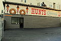
File:Hunt'sDonuts.JPG ...n 16th and 24th in the early 90s, and the Hunt’s at the corner of 20th and Mission was the most notorious, known as “the epicenter of crime” in San Franci(3,250 × 2,175 (3.09 MB)) - 22:08, 24 May 2014
File:Marty Montemayor and Roger Alvadaro.jpg ...n 1969. Here they staff a booth at a community fair at Precita Park in the Mission District of San Francisco.(624 × 696 (68 KB)) - 10:37, 8 December 2011
File:17 at sf media archive-mission local.jpg The “17 in hiding at the SF Media Archive. From Mission Local article: http://missionlocal.org/2010/05/17-reasons-remembered/(720 × 480 (186 KB)) - 18:51, 14 November 2013
File:Why1-mission local.jpg The “Why”, up in a Shotwell Street backyard. From Mission Local article: http://missionlocal.org/2010/05/17-reasons-remembered/(720 × 540 (189 KB)) - 18:54, 14 November 2013
File:Bart5.jpg The Look of Rapid Transit: 24th Street Mission station (1962). Image from Eric Fischer. https://www.flickr.com/photos/walk(1,321 × 971 (272 KB)) - 09:34, 10 October 2016
File:Redlick building 1935 AAC-7335.jpg 17th and Mission in 1935. SF History Center, SF Public Library(294 × 400 (44 KB)) - 18:55, 14 November 2013
File:Folsom and 15th 2023.JPG Folsom Street and 15th Street looking north. UCSF Mission Center. 1/20/23.(640 × 480 (144 KB)) - 19:03, 20 January 2023
File:View S from Mission at 16th 1940 AAB-4694.jpg 17th and Mission in background, Redlick furniture building at far left. SF History Center, S(376 × 400 (51 KB)) - 18:57, 14 November 2013
File:Missiondoloresmural.jpg ...composite of 300+ photographs showing the top 22 by 5 feet of the mural at Mission Dolores(1,570 × 447 (795 KB)) - 18:46, 5 September 2010
File:Mission-dolores-mural-recreated.jpg mission dolores mural recreated on bartlett street at 22nd street. artists jet mar(576 × 430 (145 KB)) - 21:20, 14 April 2011
File:Bart4.jpg “24th Street Mission Station, Street Plan,” From San Francisco Bay Area Rapid Transit District(1,321 × 850 (174 KB)) - 09:34, 10 October 2016
File:Adams-house-and-mission-bay.jpg ...e at 18th and Pennsylvania on Potrero Hill, as seen from the north, across Mission Bay, in the 1880s. Irish Hill stands to the left (east) of the house, but n(648 × 347 (103 KB)) - 20:35, 15 November 2007
File:Reasons2-mission local.jpg ...was as familiar a navigational tool for as Twin Peaks or Bernal Hill. From Mission Local article: http://missionlocal.org/2010/05/17-reasons-remembered/(720 × 480 (122 KB)) - 18:53, 14 November 2013
File:Lake dolores map overlay.jpg ...aterways throughout the Bay Area. This is his map of the water flow in the Mission District. It includes historic streams, tidal inlets and marshlands that no(620 × 466 (94 KB)) - 22:05, 25 February 2011
File:Brigantine-Tahiti-B7.9.162n.jpg Tahiti. Another brigantine built by Matthew Turner on Mission Creek was the Tahiti, a brig of 190 tons gross burden, launched in 1881. Th(576 × 413 (68 KB)) - 19:02, 22 April 2011


