SF's Southern Edge: Difference between revisions
(changed credit on 1928 SFPL photo which came from C.R. collection) |
No edit summary |
||
| (2 intermediate revisions by the same user not shown) | |||
| Line 12: | Line 12: | ||
''Photo: San Francisco Planning Commission'' | ''Photo: San Francisco Planning Commission'' | ||
[[Image:March 8 1905 View north from Visitacion Point Brisbane, View north to Bayview Hill and Candlestick Point (The first hill at center was flattened for bay fill). Southern Pacific Bayshore yards site.wnp27.6366.jpg|792px]] | |||
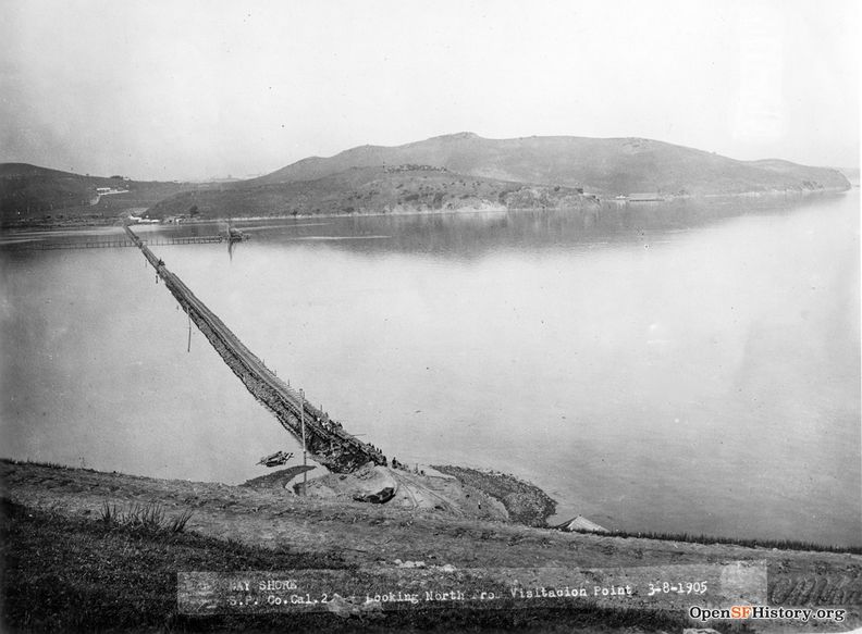
'''March 8, 1905 view north from Visitacion Point, Brisbane. The first hill across the water was flattened for bay fill that became the Southern Pacific bayshore railyards.''' | |||
''Photo: OpenSFHistory.org wnp27.6366'' | |||
[[Image:The Bayshore yard in 1983, with train traffic. Courtesy Reg McGovern. bayshore-yard-info 10-1983 regmcgovern.jpg|720px]] | [[Image:The Bayshore yard in 1983, with train traffic. Courtesy Reg McGovern. bayshore-yard-info 10-1983 regmcgovern.jpg|720px]] | ||
| Line 29: | Line 35: | ||
'''From inside the old SP roundhouse, 2010.''' | '''From inside the old SP roundhouse, 2010.''' | ||
[[Image: | [[Image:July 9 1917 Bayshore south of Visitacion Valley dpwbook19 dpw4509 wnp36.01644.jpg|792px]] | ||
'''Bayshore highway wrapping around San Bruno Mountain, south of Visitacion Valley, July 9, 1917.''' | |||
'' | ''Photo: OpenSFHistory.org wnp36.01644; DPW Book 19, DPW 4509'' | ||
[[Chinese shrimping village| Prev. Document]] [[Bayshore views | Next Document]] | [[Chinese shrimping village| Prev. Document]] [[Bayshore views | Next Document]] | ||
[[category:Bayview/Hunter's Point]] [[category:Shoreline]] [[category:Water]] [[category:1920s]] [[category:1970s]] [[category:Roads]] [[category:Transit]] [[category:2010s]] [[category:Visitacion Valley]] [[category:San Francisco outside the city]] | [[category:Bayview/Hunter's Point]] [[category:Shoreline]] [[category:Water]] [[category:1920s]] [[category:1970s]] [[category:Roads]] [[category:Transit]] [[category:2010s]] [[category:Visitacion Valley]] [[category:San Francisco outside the city]] [[category:1900s]] [[category:1910s]] | ||
Revision as of 01:36, 19 January 2020
Unfinished History
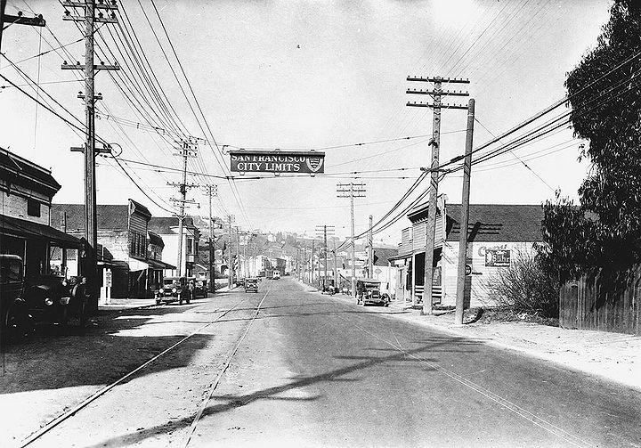
San Bruno Avenue, now Bayshore Boulevard, at intersection with Sunnydale Avenue, 1928. Southern Pacific yards and roundhouse are to the east (right) of this photo, where they were established on the landfill in what was once known as Candlestick Cove, or Brisbane Lagoon.
Photo: San Francisco History Center, SF Public Library
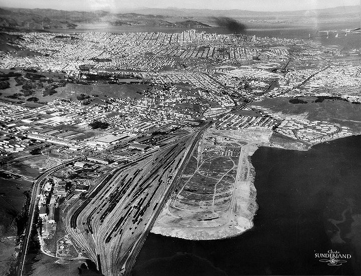
Northerly view from above San Bruno Mountain with railyards and San Francisco dump in foreground, SF city limits not far north of the bottom of the photo.
Photo: San Francisco Planning Commission
March 8, 1905 view north from Visitacion Point, Brisbane. The first hill across the water was flattened for bay fill that became the Southern Pacific bayshore railyards.
Photo: OpenSFHistory.org wnp27.6366
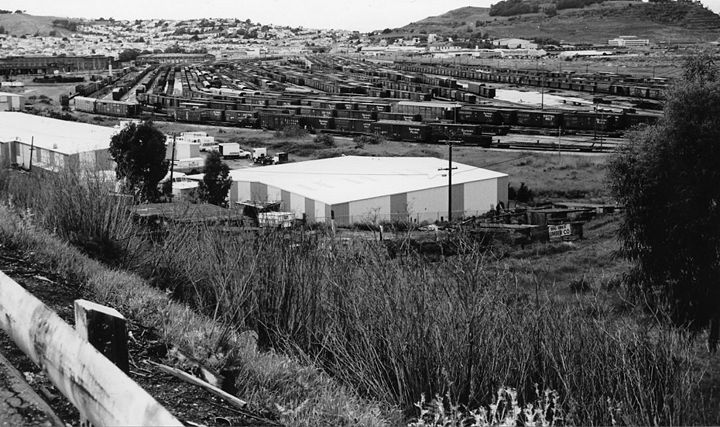
The Bayshore yard in 1983, with train traffic, straddling the political boundary between San Francisco and San Mateo counties.
Photo: courtesy Reg McGovern
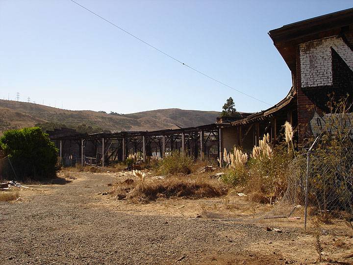
Old Southern Pacific roundhouse, long abandoned, in Bayshore train yard, 2010.
Photo: Chris Carlsson
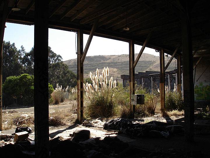
From inside the old SP roundhouse, 2010.
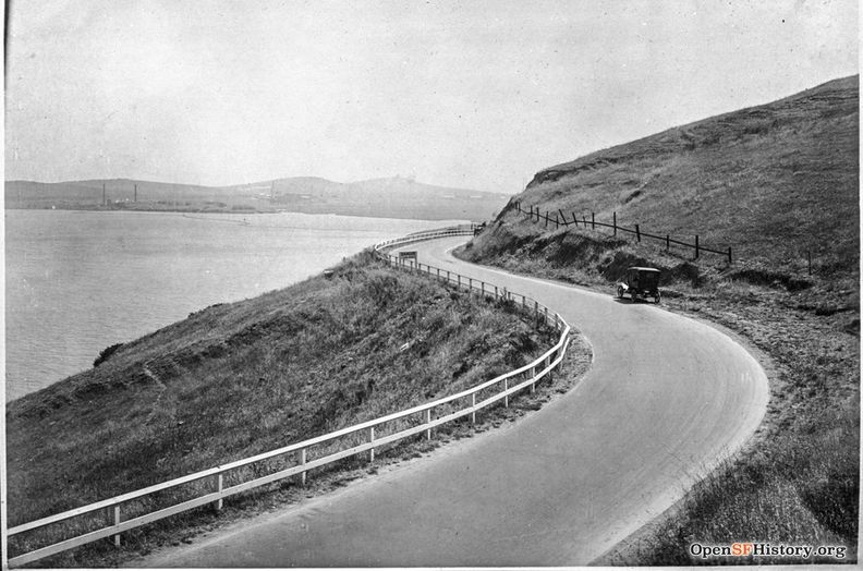
Bayshore highway wrapping around San Bruno Mountain, south of Visitacion Valley, July 9, 1917.
Photo: OpenSFHistory.org wnp36.01644; DPW Book 19, DPW 4509

